We want to get this up as quickly as possible, so we may update it later. We just wanted you to get an idea, as we are, just how cool it is to live right at the base of Da Tun Shan, the mountain that dominates the skyline in Beitou.
In the true spirit of "Let's Go Take a Look," Ping said, "You feel like going for a hike today?" YES! It took us a bit to decide what to wear, what to bring with us, etc. We haven't been able to take a real hike for MONTHS so it's been a long time. Plus, we're in Taiwan. How different should that be from any other hike?
Well, it's a totally different climate. We finally headed out the door around 10:00 AM, walked all the way to the trail and then Ping said, "Did you remember to lock the front door?" Mark couldn't remember, so we turned around and headed back. Here's a bit of perspective. That whole round trip was 26 minutes. The trail entrance is a 13 minute
walk from our front door. Nice.
We took our time on this one. It was well worth it!
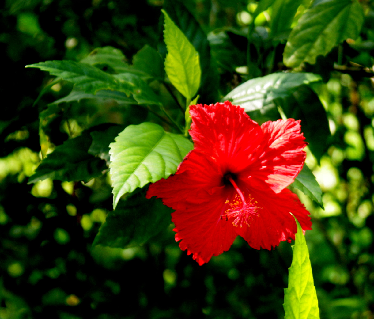
Just on the way down the back alley from our house to the main drag, Zhonghe Jie, we passed this bit of flora just blooming away! So many flowers in Taiwan! It's truly amazing.
Had to take a picture of this scooter. Note the ordinal number: "21th." Indeed! You should see the 22th!
Typical weather for this time of year. We're getting used to being on an island with stark mountains on it. You get island weather, tropical weather and mountain weather, all in the same small space. What's happening in the sky above you depends on your position, especially your elevation. It's raining up there, drizzling down here. Not bad. It's not cold, and it's not hot on this particular day...which means anything could happen. Still, whenever we decide to
just go take a look, it's always worth it!
This is a quick shot of the "trail." It's not the typical Yosemite, or Cascade or Zion sort of trail we're used to. Here they have to pave it or they'll never keep it clear!
That scar on the hill is a good reference point. We'll see it again later.
This beautiful egret kept flying just ahead of us. Ping says it was leading us on, making sure we went up. Once it was sure we were committed, it finally turned around and went back downstream. Such exquisite white plumage!
Here's a good look at the cliff. Mark always has to take pictures of the Bones of the Earth anytime he sees them.
Okay, NOW we start to climb. This is what the majority of the trail looks like! Imagine how it must have been to cart all this stone up the trail, mix the mortar and build these steps! There are thousands upon thousands of these steps all over Taiwan. The railings on the side are cast concrete painted to look like bamboo and wood. They had to haul that up the hill, too. Wow.
Yeah, it switches back several times, even though they've built the steps for you.
Hmmm....the "rubbing station?" Ping and I speculated on what that might mean.
We found out it had to do with taking rubbings from bas relief sculptures that show you've been to this point. Ooooohhhh, now I get it.
More concrete painted meticulously to look like wood.
Still paved, even though it's a gradual incline. Isn't this a beautiful leafy tunnel, though?
Seconds after Mark snapped this frame, an older man on a motorcycle emerged from that tunnel and came coasting down the trail with the engine off.
"Is that legal?" asked Ping. Mark said, "He's lived here long enough, he can do whatever he wants!"
And after a long, hard climb, you get to this charming rest area. Have a seat; take a load off! Okay, maybe not on
that one.
It's not easy to see, but this tree is
loaded with pomelos! They're like massive grapefruit, very pulpy, not as sweet, but quite good. The skin is thicker than the palm of your hand sometimes, and it's a bugger to peel, but it's nice to eat. You'll be full.
Just up the road from the pomelo tree was this overgrown play area. Goodness knows how long it's been since anyone played here! Maybe a week?
Just as he was about to snap the playground shot, Mark got a glimpse of something yellow and black hanging in the breeze at about elbow height. He couldn't get a clean picture of it since the wind was blowing, but not long after that, we came across this immobile example of the same arachnid lying on the trail. We're not sure if this one was dead or if it was merely the abandoned exoskeleton of the spider who had merely outgrown it and had to cast it off! In any case, if Mark had dared lay his hand on it, the legs would have stuck out past the sides of his palm. Gives you an idea of the size of this thing. We've seen them before on other hikes. Pretty impressive.

The leaves are turning! We can't wait to see more.
This is a look across a steep little gully toward a small rest area. Off in the distance is Taipei. We're up at about 600 meters here.
Ah, the Tea Station! This is set up so that you can stop and make tea while you're on the trail. Last time we were hiking in Taiwan, we met a mountaineer at a trail junction who was brewing tea on his high-tech stove, happily serving anyone who had a cup handy. We're going to come up here and make espresso some morning. :)
To get to the little rest area, you have to go down to the bridge. Key word here is "down."
The view from the bridge. I didn't get a good shot of the water burbling down some 50 meters between the boulders on the opposite side. Maybe next time...!
The coolest thing is: there will be a next time! Did I mention the trail entrance is a 13 minute walk from our front door?
Once you get to the rest area, you can do situps, just in case the stairs weren't enough for you.
The sign says, essentially: "Use what you need, and then please put things away."
This is where you can thank the spirits in charge of this mountain. We said thank you three times, as is the custom. There's a little statue inside the shrine there.
Doesn't that look like an Ent back there, peeking out at us from behind the shrine? I swear...!
This is just past the shrine, moving along the ridge now.
Oh, good! A restroom! This is where the guys get to go. It's airy, breezy, Level II exposure...
But what a view! Yes, it has a window.
Ping says that according to one of the signs, the toilet and the bird watching blind are one and the same.
Just around the corner, you can freshen up a bit before you head on down the trail again.
The Little Girls' Room has a bit more privacy.
Heading down more stairs. We drop a elevation pretty quickly right after the rest stop. The sky cleared up and the sun came out. Lucky us, it was not a hot day, absolutely beautiful weather for hiking! (We do wonder how that lamppost grew there, though.)
These were abundant! Mark was able to get one good shot.
There were so many butterflies, species we had never seen in the U.S. This one was almost completely black and its rear feathers were just shredded, but it flew beautifully everywhere. Mark called it the Goth Butterfly. Gorgeous.

Not far down the trail, we came to an open area which we were told was a campground. This is also part of the school where they teach soils and water management.
This is what lies up those stone steps and beyond the grand gate! It's truly a lovely park.
On the backside of the park there stands a gazebo. Someone did a little artwork just under the bench.
This is that same scar we pointed out earlier. When we were on the ridge, we were looking down on the back of this prow. The signs point out that it's a mix of volcanic andesite at the top, coal in the middle (really? Wow) and sandstone underneath. The whole center section is folded in half. Pretty cool. Mark hopes to come back to do some plein aire painting here.
We saw some steps leading down. Okay, almost STRAIGHT down. What the heck, it's the quickest way to lose elevation, right? But they lead into a bowl shaped amphitheater area at the base of the cliff. And that means we have to climb back
out. Well...down we went.
Here's the amphitheater. Pretty nice looking.
After we wandered around a bit, we had to go back up to rejoin the trail. These steps are between 15 and 20 cm high. And you can see how Mark's size 12 feet don't really fit. That toe is jammed all the way to the riser.
There are three flights of stairs from the bottom to the top. Each one has taller steps than the previous one. That's what Mark said, anyway, and he's sticking to it.
On the way back home from the trail entrance, we discovered the local branch of the Beitou library. This is the section for new immigrants. Look! English!
Next door to the library is the police station. Its front entrance is flanked by two ancient boxwood trees grown as bonsai. The trunk on this one is probably as thick as Mark's forearm at the base where the roots begin to branch out. The other one is even thicker!
If you join the Beitou police force, you, too, will be THIS cool,
guaranteed!
After having seen this image many times from the bus, we had to record it. Mark took this picture very quickly, half expecting one of the weapon wielding Cool Ones to emerge from the sliding glass doors, gun blazing, kill stats reeling away until "DING! Level UP! Congratulations! You are now HyperCop Level VII!"
We continued on without incident, found a good bento place to eat on the way home ($NT115 for both of us! --just under $4.00 US) and blessed our bodies for making it all the way up and back.
With any luck, we'll do even longer loops. There are many available from this trail entrance alone...and all in our own backyard!! Amazing.
Did I mention the entrance to this trail is a 13 minute walk from our front door?


 The leaves are turning! We can't wait to see more.


 Not far down the trail, we came to an open area which we were told was a campground. This is also part of the school where they teach soils and water management.


Fabulous - thanks once again for posting all this! I'm really happy to know all this is so close to your home.
ReplyDeleteBeautiful pic of the egret. As for egrets, I've had a few, but then again, too few to mention...
Great to note your impressions as you navigate your way in the new environment.
ReplyDelete